Location
Ridge and Valley Province of the Tennessee River
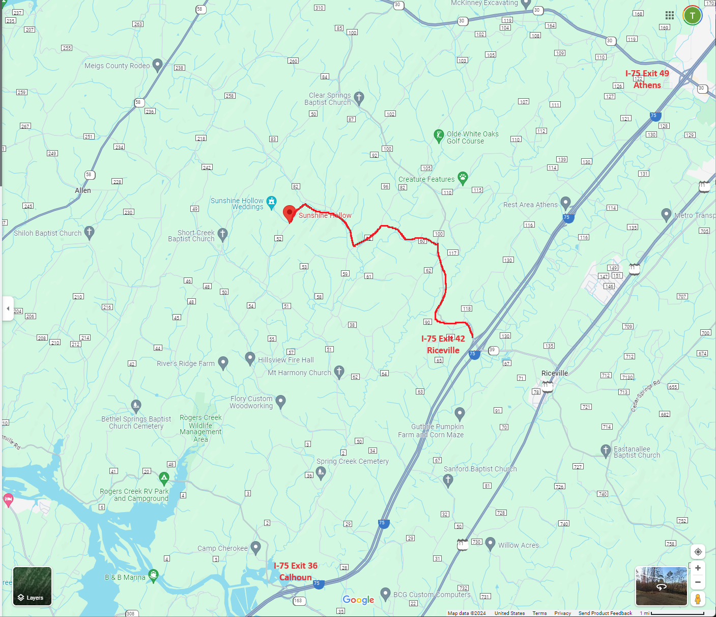
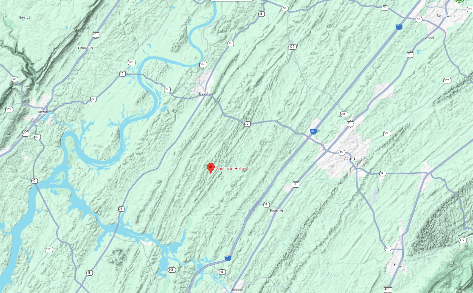
This map shows the current road structure through the Great Valley and the path of the Tennessee River on the West and the Appalachians on the East. The Great Valley and its ridges run generally from southwest to northeast. Sunshine Hollow is situated between Chattanooga and Knoxville and centered between the Cumberland Plateau to the west and the Appalachian foothills to the east. As the crow flies, it's located about five miles northwest of exit 42 which is the Riceville exit on Interstate 75, or about six and one-half miles by car. The Hollow is twelve miles by car from Exit 49, the Athens exit, and fourteen miles from Exit 39, the Calhoun exit. The Hollow is about 20 miles from Cleveland and 40 miles from Chattanooga and about an hour's drive from Knoxville. The Hollow is also accessible by road from many different directions: Highway 30 from Dayton and Etowah, Highway 68 from Spring City and Crossville, and Highway 58 from Harrison, Rockwood, and Kingston. The approximate location of the Hollow is shown on the map with a marker.
Topographic Map of East Tennessee
Geology
Sandstone Formation
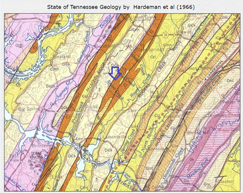
The sandstone that forms the hollow is at the edge of two major periods of Geologic history, the Ordovician and Ordovician-Cambrian periods. The Hollow is on the east side of a ridge running generally North-South that forms the border of the Hollow on the West end and the valley to the West (Near McMinn County – Meigs County border), The valley on the West side is Ordovician, and the surface rock there is chert. That valley is very dry compared to the Hollow side of the ridge where even near the top of the ridge wet weather springs can be found. Source: State of Tennessee Geology by Hardeman et al (1966). Sunshine Hollow is between Brush Creek and Short Creek at the end of the blue arrow.
Aspect and Slopes
Drainage and slopes in the Hollow include almost every Aspect. From East, South East, South, South West, West, North West, North, and North East but the mouth of the Hollow generally faces somewhat Easterly. Having this many aspects with slopes that are very dry to slopes that are moist through most of the year combined with multiple water sources, offers the opportunity for a variety of plant and tree species. Slopes in the Hollow are gentle to very steep with hardly any truly flat ground. Heavy rainfall would leave the watershed very rapidly except for the heavy canopy and mature forest that covers most of the area.
Demographics & Visitation Potential
Population within 25 miles – 171,000
Population within 50 miles – 1,300,000
Population within 75 miles – 2,600,000
Interstate I-75 traffic figures: 210,000 vehicles per day or annually - 76,000,000
Local attractions drawing traffic to east Tennessee (Knoxville Region)
- Great Smoky Mountains NP (2021 Est. 14,000,000)
- Gatlinburg,
- Pigeon Forge,
- Dollywood,
- Ripley's Aquarium
- Area (Estimate 10,000,000 to 12,000,000)
Local attractions drawing traffic to southeast Tennessee (Chattanooga Region)
- Chattanooga Aquarium, Chickamauga Battlefield NP,
- Rock City,
- Lookout Mountain,
- Ruby Falls,
- Point Park: (Est. 3,000,000)
Composite potential visitation pool:
Population within 75 miles – 2,600,000
Visitor potential draw within 75 miles – 17,000,000 (Some of this is overlap)
Travelers on I-75 (6.5 miles away) – 210,000 cars per day (76,000,000 cars per year)
Access Points
I-75-Three Exits
Exit 49 Athens Exit-12 miles (Time to Hollow-15 minutes)
Exit 42 Riceville Exit-6.5 miles (Time to Hollow – 13 minutes)
Exit 36 Calhoun Exit-9.5 miles (Time to Hollow - 15 minutes)
Each one of the Interstate exits offers a very scenic drive across the ridges and valleys of the Great Valley of the Tennessee river giving the visitor a chance to see the ridges, farmland, and creeks that form the drainage's. All of the State and County roads to the Hollow are paved and well maintained.
Dayton via Highway 30 (Time to Hollow – 30 minutes)
Spring City via Highway 30 and Highway 68 (Time to Hollow – 30 minutes)
Figures are from the latest Visitor Bureaus and other sources.


